Choose Which Site You Want To See


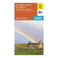
Explorer Ol 42 Kielder Water & Forest Map: The essential map for outdoor activities in Kielder Water and Forest. The OS Explorer Map is the Ordnance Surveyâs most detailed folding map and is recommended for anyone enjoying outdoor activities including walking, horse riding and off-road cycling. This map now comes with a digital version which you can download to your smartphone or tablet.
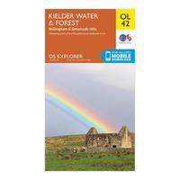
Ordnance Survey Explorer Ol 42 Kielder Water & Forest Map, Orange: The essential map for outdoor activities in Kielder Water and Forest. The OS Explorer Map is the Ordnance Survey\'s most detailed folding map and is recommended for anyone enjoying outdoor activities including walking, horse riding and off-road cycling. This map now comes with a digital version which you can download to your smartphone or tablet. Colour Swatch:OrangeBrand:ORDNANCE SURVEYColour:Orange
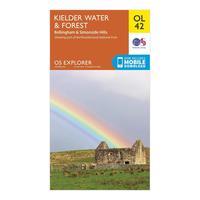
Ordnance Survey Explorer Ol 42 Kielder Water & Forest Map, Orange: The essential map for outdoor activities in Kielder Water and Forest. The OS Explorer Map is the Ordnance Survey\'s most detailed folding map and is recommended for anyone enjoying outdoor activities including walking, horse riding and off-road cycling. This map now comes with a digital version which you can download to your smartphone or tablet. Colour Swatch:OrangeBrand:ORDNANCE SURVEYColour:Orange
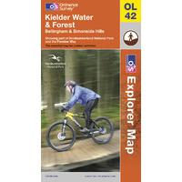
Kielder Water & Forest - Os Explorer Active Map Sheet Number Ol42: Purchase the Kielder Water & Forest folded map: double-sided (boarded cover) from the OS Explorer Map range
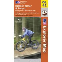
Kielder Water & Forest - Os Explorer Map Sheet Number Ol42: Purchase the Kielder Water & Forest folded map: double-sided (boarded cover) from the OS Explorer Map range
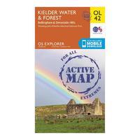
Ol 42 Explorer Kielder Water & Forest Active Map: Map sheet OL42 in the OS Explorer series covers an area of Northumberland National Park stretching from Kielder Forest in the west to Netherwitton in the east, and takes in the town of Bellingham. Highlights of the area include: Bloody Bush & Larriston Fells Walk around Kielder Water, The Pennine Way national trail and St. Oswald\'s Way.
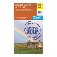
Ordnance Survey Ol 42 Explorer Kielder Water & Forest Active Map, Orange: Map sheet OL42 in the OS Explorer series covers an area of Northumberland National Park stretching from Kielder Forest in the west to Netherwitton in the east, and takes in the town of Bellingham. Highlights of the area include: Bloody Bush & Larriston Fells Walk around Kielder Water, The Pennine Way national trail and St. Oswald\'s Way. Colour Swatch:OrangeBrand:ORDNANCE SURVEYColour:Orange
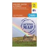
Ordnance Survey Ol 42 Explorer Kielder Water & Forest Active Map, Orange: Map sheet OL42 in the OS Explorer series covers an area of Northumberland National Park stretching from Kielder Forest in the west to Netherwitton in the east, and takes in the town of Bellingham. Highlights of the area include: Bloody Bush & Larriston Fells Walk around Kielder Water, The Pennine Way national trail and St. Oswald\'s Way. Colour Swatch:OrangeBrand:ORDNANCE SURVEYColour:Orange

Ordnance Survey Explorer 414 Glan Shiel & Kintail Forest Map With Digital Version, Orange: The essential map for outdoor activities in Glan Shiel and Kintail Forest. The OS Explorer Map is the Ordnance Survey\'s most detailed folding map and is recommended for anyone enjoying outdoor activities including walking, horse riding and off-road cycling. This map now comes with a digital version which you can download to your smartphone or tablet. Providing complete GB coverage, the OS Explorer map series details information essential in the great outdoors, including youth hostels, pubs and...

Ordnance Survey Explorer Active 157 Marlborough & Savernake Forest Map With Digital Version, Orange: The essential map for outdoor activities in all weathers in Marlborough and Savernake Forest. The OS Explorer Active Map is the Ordnance Survey\'s most detailed folding map and is recommended for anyone enjoying outdoor activities including walking, horse riding and off-road cycling. This map now comes with a digital version which you can download to your smartphone or tablet. Providing complete GB coverage, the OS Explorer map series details information essential in the great outdoors,...

Ordnance Survey Explorer Active 186 Llandeilo & Brechfa Forest Map With Digital Version, Orange: The essential map for outdoor activities in all weathers in Llandeilo and Brechfa Forest. The OS Explorer Active Map is the Ordnance Survey\'s most detailed folding map and is recommended for anyone enjoying outdoor activities including walking, horse riding and off-road cycling. This map now comes with a digital version which you can download to your smartphone or tablet. Providing complete GB coverage, the OS Explorer map series details information essential in the great outdoors, including...

Ordnance Survey Explorer Active 218 Kidderminster & Wyre Forest Map With Digital Version, Orange: The essential map for outdoor activities in all weathers in Kidderminster and Wyre Forest. The OS Explorer Active Map is the Ordnance Survey\'s most detailed folding map and is recommended for anyone enjoying outdoor activities including walking, horse riding and off-road cycling. This map now comes with a digital version which you can download to your smartphone or tablet. Providing complete GB coverage, the OS Explorer map series details information essential in the great outdoors, including...
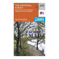
Ordnance Survey Explorer Active 245 The National Forest Map With Digital Version, Orange: The essential map for outdoor activities in all weathers in The National Forest. The OS Explorer Active Map is the Ordnance Survey\'s most detailed folding map and is recommended for anyone enjoying outdoor activities including walking, horse riding and off-road cycling. This map now comes with a digital version which you can download to your smartphone or tablet. Providing complete GB coverage, the OS Explorer map series details information essential in the great outdoors, including youth...

Ordnance Survey Explorer Active 324 Liddersdale & Kershope Forest Map With Digital Version, Orange: The essential map for outdoor activities in all weathers in Liddersdale and Kershope Forest. The OS Explorer Active Map is the Ordnance Survey\'s most detailed folding map and is recommended for anyone enjoying outdoor activities including walking, horse riding and off-road cycling. This map now comes with a digital version which you can download to your smartphone or tablet. Providing complete GB coverage, the OS Explorer map series details information essential in the great outdoors, including...

Ordnance Survey Explorer Active 267 Northwich & Delamere Forest Map With Digital Version, Orange: The essential map for outdoor activities in all weathers in Northwich and Delamere Forest. The OS Explorer Active Map is the Ordnance Survey\'s most detailed folding map and is recommended for anyone enjoying outdoor activities including walking, horse riding and off-road cycling. This map now comes with a digital version which you can download to your smartphone or tablet. Providing complete GB coverage, the OS Explorer map series details information essential in the great outdoors, including...

Ordnance Survey Explorer Active 157 Marlborough & Savernake Forest Map With Digital Version, Orange: The essential map for outdoor activities in all weathers in Marlborough and Savernake Forest. The OS Explorer Active Map is the Ordnance Survey\'s most detailed folding map and is recommended for anyone enjoying outdoor activities including walking, horse riding and off-road cycling. This map now comes with a digital version which you can download to your smartphone or tablet. Providing complete GB coverage, the OS Explorer map series details information essential in the great outdoors,...

Ordnance Survey Explorer Active 186 Llandeilo & Brechfa Forest Map With Digital Version, Orange: The essential map for outdoor activities in all weathers in Llandeilo and Brechfa Forest. The OS Explorer Active Map is the Ordnance Survey\'s most detailed folding map and is recommended for anyone enjoying outdoor activities including walking, horse riding and off-road cycling. This map now comes with a digital version which you can download to your smartphone or tablet. Providing complete GB coverage, the OS Explorer map series details information essential in the great outdoors, including...
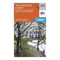
Ordnance Survey Explorer Active 245 The National Forest Map With Digital Version, Orange: The essential map for outdoor activities in all weathers in The National Forest. The OS Explorer Active Map is the Ordnance Survey\'s most detailed folding map and is recommended for anyone enjoying outdoor activities including walking, horse riding and off-road cycling. This map now comes with a digital version which you can download to your smartphone or tablet. Providing complete GB coverage, the OS Explorer map series details information essential in the great outdoors, including youth...

Ordnance Survey Explorer Active 324 Liddersdale & Kershope Forest Map With Digital Version, Orange: The essential map for outdoor activities in all weathers in Liddersdale and Kershope Forest. The OS Explorer Active Map is the Ordnance Survey\'s most detailed folding map and is recommended for anyone enjoying outdoor activities including walking, horse riding and off-road cycling. This map now comes with a digital version which you can download to your smartphone or tablet. Providing complete GB coverage, the OS Explorer map series details information essential in the great outdoors, including...

Ordnance Survey Explorer Active 218 Kidderminster & Wyre Forest Map With Digital Version, Orange: The essential map for outdoor activities in all weathers in Kidderminster and Wyre Forest. The OS Explorer Active Map is the Ordnance Survey\'s most detailed folding map and is recommended for anyone enjoying outdoor activities including walking, horse riding and off-road cycling. This map now comes with a digital version which you can download to your smartphone or tablet. Providing complete GB coverage, the OS Explorer map series details information essential in the great outdoors, including...